IJsselstein, Tuesday, 26 March 2002 05:12:34
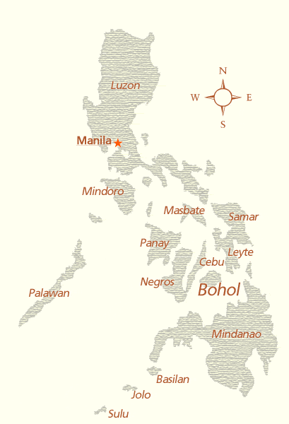
Bohol is an island located between latitude 9°30' and 10°15' North and Longitude 123°40' and 124°30' East.
With a land area of 4117.3 square kilometers, Bohol is the tenth largest island of the Philippines, and lies in the middle of the Visayas. Bohol is surrounded by other islands on all sides, and is thus shielded from the typhoons that often occur in the region, as well as from the heaviest rains.
Bohol is separated from Mindanao by the Bohol sea in the South and the island of Leyte by the Canigao Channel in the East. The Comotes sea in the North separates Bohol from the Camotes Islands, and the Bohol Strait separates it from Cebu.
On the overview map below, you can see the location of Bohol in the Philippines.
Jeroen Hellingman